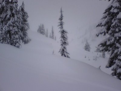
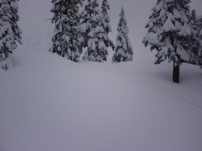
OK. It's DUMPING in the Cascades.
I'm heading to Mt Baker to ski the deep powder.
Leaving @ 6am. Back around 7-8pm.
Call for help I'm if not back by 10pm.

Suffice it to say that I will be bringing:
my avalanche beacons,
probe,
and shovel.

This is is a serious dumping that is not for the feint of heart.

:)

I love the interweb.

Look at the wealth of resources that are helping me make my decision.

1. KIRO TV Pacific Satellite Loop
2. KIRO TV Local Doppler Radar Loop
2. WA State DOT Mountain Passes
3. BACKCOUNTRY AVALANCHE FORECAST [Nov 23 report beloe]
4. Mt Baker Conditions
5. Technorati Search for >> skiing seattle baker, led me to [6]
6. Pics taken from Mt. Baker today [gotta love the blogosphere]

Cameraphone pics to follow on my flickr stream

--brian

===========
Source: http://www.nwac.us/products/SABSEA

BACKCOUNTRY AVALANCHE FORECAST FOR THE OLYMPICS WASHINGTON
CASCADES AND MT HOOD AREA
NORTHWEST WEATHER AND AVALANCHE CENTER SEATTLE WASHINGTON
0845 AM PST THU NOV 23 2006

NWAC Program administered by:
USDA-Forest Service
with cooperative funding and support from:
Washington State Department of Transportation
National Weather Service
National Park Service
Washington State Parks and Recreation Commission
Pacific Northwest Ski Area Association
Friends of the Avalanche Center
and other private organizations.

This forecast applies to back country avalanche terrain below
7000 feet and does not apply to highways or operating ski
areas.

WAZ513-518-519-019-042-501-502-ORZ011-241700-

&&

ZONE AVALANCHE FORECASTS

* OLYMPICS, WASHINGTON CASCADES NEAR AND WEST OF THE
CREST, MT HOOD AREA-
Considerable avalanche danger above 5 to 6000 feet and
moderate below increasing Thursday and becoming
considerable above 5000 feet and moderate below late
Thursday except for locally high danger on southeast
through northeast facing slopes above 5 to 6000 feet.
Further increasing danger likely Thursday night and
Friday, becoming considerable above 4000 feet and
moderate below except for locally high danger on
southeast through northeast exposures above about 5000
feet.

* EAST SLOPES WASHINGTON CASCADES-
Moderate avalanche danger above 5000 feet and low below
increasing Thursday and becoming moderate above 4 to
5000 feet and low below except for locally considerable
above 6000 feet on southeast through northeast
exposures, especially steeper terrain near the crest.
Further slowly increasing danger likely Thursday night
and Friday, becoming moderate below 7000 feet except
for locally considerable danger above 5 to 6000 feet on
lee slopes.

SNOWPACK ANALYSIS

In most mid and upper elevations of the Olympics and
areas near and west of the Cascade crest, increasingly
large recent new snow accumulations have been deposited
over the generally stable and increasingly refrozen old
snowpack during the past three days, with accumulated
snowfall totals generally ranging from around 20 to over
40 inches. Along with relatively low freezing levels and
intermittently strong winds this new snowfall has
produced a generally increasing danger, especially at
higher elevations on north through east facing slopes
where the danger is now considerable and human triggered
avalanches have become probable. On these lee slopes,
some weak layers created during intermittent breaks in
snowfall or briefly decreased winds may now be buried by
wind slabs of up to 1 to over 3 feet and travelers should
exercise increasing caution in such steeper lee terrain.
Also, with the recent cooling, field reports indicate
that slow weakening of the snow near the interface of the
recent snow and the old rain crust is occurring and more
faceting and weakening of this bond is expected over the
next few days. At lower elevations and along the Cascade
east slopes, less recent snowfall has been received along
with a still relatively shallow but increasing snowpack.
This is resulting in an overall lower danger, but here
too the danger is increasing especially on lee slopes
where initially shallow but increasing wind slabs are
developing.

DETAILED FORECASTS

THURSDAY, THURSDAY NIGHT-

Moderate snow or snow showers early Thursday should
increase later Thursday morning through Thursday night,
with locally heavy snow accumulations likely in many
locations especially in the Olympics and most locations
near and west of the Cascade crest. Along with moderate
to strong ridgetop winds and continued relatively low
freezing levels, this should create increasing wind slabs
over several weak layers formed during breaks in snowfall
either Tuesday or Wednesday, especially above about 5 to
6000 feet where most potential anchors are rapidly being
buried. At lower elevations of the Olympics and Cascades
near and west of the crest, a still relatively shallow
snowpack is helping to limit the danger. However, with
anticipated heavy snowfall, many of the existing anchors
should be progressively buried, thus producing a
generally increased danger here as well, especially on
steeper terrain having a smooth underlying ground
surface. Also, the overall colder weather projected
through the remainder of the week should allow for
further weakening and faceting of the snowpack near the
interface with the old rain crust formed last Sunday.
While most avalanche activity should involve only the
most recently received new snowfall, some larger slides
may break down to the old crust and involve all of the
snowfall received since last weekend. As a result,
travelers are urged to monitor and assess the bond at
this old interface and perform stability tests on this
developing weakness, and travel is not recommended in
steeper, higher elevation lee terrain on Thursday.

While less snowfall expected along the Cascade east
slopes should help to limit the increase in the danger
particularly at lower elevations where a much shallower
snowpack remains, significant loading is nevertheless
expected on lee exposures at higher elevations,
especially near the Cascade crest. Hence locally
considerable danger is still likely on southeast through
northeast aspects above 6000 feet with moderate danger
developing on smooth, steeper lee slopes at lower
elevations.

FRIDAY, FRIDAY NIGHT-

Further moderate to occasionally heavy snow and moderate
winds are expected at low and lowering freezing levels
for much of Friday. This weather should produce further
increasing danger, with the danger accentuated on
northeast through southeast facing slopes at all
elevations. On lee terrain, unstable slabs should become
likely above about 5000 feet and travel in such terrain
is still not recommended, especially during heavy
snowfall. It should be noted that due to wind effects,
significant differences in snow stability may exist over
very short distances near ridgelines. Some wind exposed
terrain may be scoured down to near the old stable rain
crust with nearby lee slopes having substantial wind
deposits and a likelihood of human triggered slab
releases. Slowly decreasing showers and winds expected
Friday night should allow for a slow decrease in the
danger as new wind slabs begin to settle. However,
anticipated cold temperatures should make this
stabilization a very slow process, and further faceting
and weakening near the old crust should maintain a threat
of isolated larger slide releases on steeper lee terrain
above about 5 to 6000 feet.

&&

Backcountry travelers should be aware that elevation and
geographic distinctions are approximate and that a transition
zone between dangers exists.  Remember there are avalanche
safe areas in the mountains during all levels of avalanche
danger.  Contact local authorities in your area of interest
for further information.

NWAC weather data and forecasts are also available by calling
206-526-6677 for Washington, 503-808-2400 for the Mt Hood
area, or by visiting our Web site at www.nwac.us.

Moore/Northwest Weather and Avalanche Center

$$


